As a leader of the Work Package 6: “Dissemination, Multi-stakeholder outreach and synergies,” Pensoft is tasked to build an involved community around OBSGESSION.
Pensoft is to contribute to the OBSGESSION consortium with expertise in science communication by taking care of stakeholders engagement, thereby supporting its goal of improved terrestrial and freshwater biodiversity monitoring. As a leader of the Work Package 6: “Dissemination, Multi-stakeholder outreach and synergies,” Pensoft is tasked to build an involved community around OBSGESSION.
Terrestrial and freshwater biodiversity has been declining at an alarming rate due various factors such as intensification of anthropogenic activities and climate change.
Coordinated by the Finnish Environmental Institute (Syke), OBSGESSION aims to reveal the drivers of biodiversity loss, pinpoint important indicators of ecosystem health and inform sustainability policy.
The OBSGESSION consortium at the kick-off meeting in January 2024 (Tuusula, Finland).
The project officially kicked off with the first consortium meeting in Tuusula, Finland, between 30th January and 2nd February.
For the coming four years, the joint mission before the newly formed consortium is to integrate biodiversity data sources, such as Earth Observation, with in-situ research, and also cutting-edge ecological models. These will all be made into a comprehensive product for biodiversity management in both terrestrial and freshwater ecosystems.
The project will also spearhead an innovative approach for assessing Essential Biodiversity Variables (EBVs) and their resilience to errors. Through purposely propagating error into biodiversity estimates and comparing the resulting models with ones using correct estimates, the EBV case studies aim to investigate model uncertainties and identify approaches that are more sensitive. Thus, they will inform policy and management about the optimal EBVs, and their key thresholds for conservation.
To demonstrate the implementation of the techniques and methodologies they are to develop within the project; and to respond to the needs of the EU Biodiversity Strategy for 2030, the consortium will focus on six distinct pilot activities:
Investigating and predicting biodiversity change in the European Alps: multi-scale, multi-modal and multi-temporal investigation using remote and in-situ data integration.
Improving habitat classification models: going beyond state-of-the-art in terms of accurate high-resolution mapping of Europe’s habitats, powered by machine learning.
Forecasting ecosystem productivity under disturbances & climate change:incorporating remote sensing EBVs to assess metrics of ecosystem structure and health.
Supporting temperate and boreal forest protection & restoration: through assessing ecosystem conditions via eDNA & image spectroscopy.
Monitoring freshwater ecosystems under disturbances & climate change: utilizing the novel Thematic Ecosystem Change Indices (TECIs).
Ecosystem functioning of the Kokemäenjoki estuary – assessing freshwater & transitional water quality incorporating both in-situ and Earth Observation data.
Through its pilot studies, methodological assessments, data stream integration, and investigating land use cover changes across Europe, OBSGESSION will help improve our understanding of ecosystem vulnerability across a range of specific habitat types, identify driversand pressures to ecosystem change and improve planning and prioritization of restoration measures.
“At Pensoft, we are eager to be part of the bright OBSGESSION consortium and look forward to offering our expertise and experience in raising awareness towards the project and contributing to the high impact of the resulting outputs, methodologies and policy recommendations that aim to strengthen our understanding of biodiversity change,”
says Gabriela Popova, science communicator at Pensoft and leader of the Work Package #6: “Dissemination, Multi-stakeholder outreach and synergies” at OBSGESSION.
International Consortium
The interdisciplinary OBSGESSION consortium consists of 11 partnering organisations from seven European countries, who bring diverse expertise spanning from remote sensing and Earth observation, to freshwater ecosystems, programming and science communication. Many partners represent acclaimed scientific institutions with rich experience in collaborative EU projects.
Pensoft is amongst the participants of a new Horizon Europe project aiming to better evaluate the risk to wild pollinators of pesticide exposure, enhancing their health & pollination services.
Wild fauna and flora are facing variable and challenging environmental disturbances. One of the animal groups that is most impacted by these disturbances are pollinators, which face multiple threats, driven to a huge extent by the spread of anthropogenic chemicals, such as pesticides.
WildPosh (Pan-european assessment, monitoring, and mitigation of chemical stressors on the health of wild pollinators) is a multi-actor, transdisciplinary project whose overarching mission and ambition are to significantly improve the evaluation of the risk to wild pollinators of pesticide exposure, and enhance the sustainable health of pollinators and pollination services in Europe.
On 25 and 26 January 2024, project partners from across Europe met for the first time in Mons, Belgium and marked the beginning of the 4-year endeavour that is WildPosh. During the two days of the meeting, the partners had the chance to discuss objectives and strategies and plan their work ahead.
This aligns with the objectives of the European Green Deal and EU biodiversity strategy for 2030, emphasising the need to reduce pollution and safeguard pollinators. WildPosh focuses on understanding the routes of chemical exposure, evaluating toxicological effects, and developing preventive measures. By addressing knowledge gaps in pesticide risk assessment for wild pollinators, the project contributes to broader efforts in biodiversity conservation.
During the kick-off meeting in Mons, WildPosh’s project coordinator Prof. Denis Michez (University of Mons, Belgium) gave an introductory presentation.
As a leader of Work Package #7: “Communication, knowledge exchange and impact”, Pensoft is dedicated to maximising the project’s impact by employing a mix of channels in order to inform stakeholders about the results from WildPosh and raise further public awareness of wild and managed bees’ health.
Pensoft is also tasked with creating and maintaining a clear and recognisable project brand, promotional materials, website, social network profiles, internal communication platform, and online libraries. Another key responsibility is the development, implementation and regular updates of the project’s communication, dissemination and exploitation plans, that WildPosh is set to follow for the next four years.
“It is very exciting to build on the recently concluded PoshBee project, which set out to provide a holistic understanding of how chemicals affect health in honey bees, bumble bees, and solitary bees, and reveal how stressors interact to threaten bee health. WildPosh will continue this insightful work by investigating these effects on wild pollinators, such as butterflies, hoverflies and wild bee species, with the ultimate goal of protecting these small heroes who benefit the well-being of our planet,”
says Teodor Metodiev, WildPosh Principal Investigator for Pensoft.
For the next four years, WildPosh will be working towards five core objectives:
1) Determine the real-world agrochemical exposure profile of wild pollinators at landscape level within and among sites
2) Characterise causal relationships between pesticides and pollinator health
3) Build open database on pollinator traits/distribution and chemicals to define exposure and toxicity scenario
4) Propose new tools for risk assessment on wild pollinators
5) Drive policy and practice.
Consortium:
The consortium consists of 17 partners coming from 10 European countries. Together, they bring extensive experience in Research and Innovation projects conducted within the Horizon programmes, as well as excellent scientific knowledge of chemistry, modelling, nutritional ecology, proteomics, environmental chemistry and nutritional biology.
There has been an increasing need to support the exchange of research related to the conservation and sustainable management of estuarine ecosystems by means of new-age technologies and approaches.
Where freshwater rivers meet seas and oceans lies a scientifically intriguing and ecologically important type of ecosystem. As estuarine ecosystems provide various and diverse services to humanity and the planet at large, including food security and natural buffers and filters in the events of storms and water pollution, there has been an increasing need to facilitate and support the exchange of research findings and ideas related to their conservation and sustainable management by means of new-age technology and novel approaches.
This is how a team of renowned and passionate scientists, headed by Dr. Soufiane Haddout (Ibn Tofail University, Morocco), took the decision to launch a brand new open-access, peer-reviewed scholarly, aptly titled Estuarine Management and Technologies. They explain the rationale behind the journal in a new editorial, published to mark the official launch of the journal.
Having already worked closely with the scientific publisher and technology provider Pensoft on the fine touches of the concept of the new academic title, the team opted to use Pensoft’s publishing platform of ARPHA. As a result, the new journal provides a seamless, end-to-end publishing experience, encompassing all stages between manuscript submission and article publication, indexation, dissemination and permanent archiving.
Within the collaboration between the journal’s and Pensoft’s teams, Estuarine Management and Technologies will take advantage of various services offered by the ARPHA platform, including full-text automated export in machine-readable and minable JATS-XML format to over 60 relevant databases for scientific literature and data; semantically enriched and multimedia-friendly publications accessible in HTML; and rich statistics about the outreach and usage of each published article and its elements (e.g. figures and tables), including views, downloads, online mentions, and citations.
The publishing platform’s in-house indexing team will continue their close work with the journal’s editors to ensure that the scholarly outlet retains highest quality and integrity, so that it covers the criteria for indexation at additional key databases that require individual evaluation. In the meantime, ARPHA’s technical and editorial teams will provide technical and customer support to authors, editors and reviewers. The marketing and promotion team of ARPHA will be also joining forces with the journal to boost the visibility and image of the new academic title.
During the launch phase, content accepted for publication following double-blinded peer review will be made public right away for free to both authors and readers, where the journal will be operating under a continuous publication model.
Estuarine Management and Technologies welcomes studies from a wide spectrum of disciplines, including physics, chemistry, geology, biology, and hydrology, with a focus on interdisciplinarity, multifaceted approaches and holistic perspectives.
“One crucial aspect of estuarine management is the sustainable use of resources to balance conservation with human needs. Striking this delicate equilibrium requires a holistic understanding of the intricate web of ecological interactions within estuarine environments. Advanced technologies, such as isotopic techniques, environmental DNA (eDNA) analysis, can provide insights into the biodiversity of estuarine ecosystems with unprecedented precision,”
explain Dr Haddout and his colleagues in the opening editorial.
Amongst the unique features of the new journal are several additional publication types, such as Expert View, Video Paper, Rapid Communication, Mini Review and Estuarine Scientists, where these have been added to traditional publication outputs (e.g. Research Paper, Review Paper, Data Paper) to foster collaboration between researchers and other stakeholders in the field.
The journal is also running an annual Trailblazing Talent in Estuarine Management and Technologies award intended to recognise and encourage young scientists and engineers at the forefront of cutting-edge research in estuarine management and technologies. Nominations and applications are currently open.
Estuarine Management and Technologies also welcomes applications for guest editors in order to further expand the journal and its immediate expert network.
“I am delighted to see the Estuarine Management and Technologies journal already live on the ARPHA platform. We are confident that this particularly important, yet so far quite overlooked area of study will greatly benefit from this highly promising journal,”
says Prof. Lyubomir Penev, CEO and founder of Pensoft and ARPHA.
“I am pleased to announce the launch of the Estuarine Management and Technologies journal on ARPHA, a decision rooted in our commitment to advancing the field. We believe that this strategic partnership will not only enhance the visibility and accessibility of our journal, but will also foster collaboration and innovation within the estuarine management and technologies community. We expect this alliance to be a catalyst for scholarly excellence, providing a robust platform for researchers and practitioners to share insights, address challenges, and propel the field forward. Together with ARPHA, we are confident in the positive impact our journal will have on shaping the future of estuarine management and technologies.”
says Dr. Soufiane Haddout, Editor-in-Chief and founder, Estuarine Management and Technologies.
***
You can visit the journal website and sign up for its newsletter from the homepage.
You can also follow Estuarine Management and Technologies onX (formerly Twitter).
Researchers of Khamai Foundation and Liberty University have discovered a new species of coffee snake endemic to the cloud forests of northwestern Ecuador.
The new species is named Ninia guytudori, in honor of naturalist Guy Tudor, in recognition of the impact he has had on the conservation of South America’s birds through his artistry. Photo by Alejandro Arteaga.
Biologist Alejandro Arteaga first found the snake in Ecuador’s Pichincha province, while looking for animals to include in a book on the Reptiles of Ecuador.
“This is species number 30 that I have discovered, out of a target of 100,” he says.
Ninia guytudori from Santa Lucía Cloud Forest Reserve, Pichincha province. Photo by Jose Vieira
Like other coffee snakes, Tudors’s Coffee-Snake often inhabits coffee plantations, especially in areas where its cloud forest habitat has been destroyed. It is endemic to the Pacific slopes of the Andes in northwestern Ecuador, where it lives at elevations of between 1,000 and 1,500 m above sea level.
While it faces no major immediate extinction threats, some of its populations are likely to be declining due to deforestation by logging and large-scale mining.
The researchers hope that its discovery will highlight the importance of preserving the cloud forest ecosystem, and focus research attention on human-modified habitats that surround it such as coffee plantations and pastures.
Photographs of some specimens of Ninia guytudori: top, from Santa Lucía Cloud Forest Reserve, Pichincha province. Bottom, from Río Manduriacu Reserve, Imbabura province. Photos by Jose Vieira
The name of the new snake species honors Guy Tudor, “an all-around naturalist and scientific illustrator with a deep fondness for birds and all animals, in recognition of the impact he has had on the conservation of South America’s birds through his artistry,” the researchers write in their paper, which was recently published in Evolutionary Systematics.
“We are trying to raise funds for conservation through the naming of new species. This one helped us protect Buenaventura Reserve.
Research article:
Arteaga A, Harris KJ (2023) A new species of Ninia (Serpentes, Colubridae) from western Ecuador and revalidation of N. schmidti. Evolutionary Systematics 7(2): 317-334. https://doi.org/10.3897/evolsyst.7.112476
Follow Evolutionary Systematics on Facebook and X.
In the depths of Ecuador’s wilderness, scientists have unveiled the presence of two new tarantula species from the slopes of the Andes in the western part of the country.
In the depths of Ecuador’s wilderness, scientists have unveiled the presence of two new tarantula species. Researchers of Universidad San Francisco de Quito found them on trees on the slopes of the Andes in the western part of the country.
Meet Ecuador’s newest tarantulas
One of them was found in late February 2023, 1.5 m above the forest floor in the foothill evergreen forest of the Cordillera Occidental . Just discovered, it is already seriously threatened as people use its habitat for mining and agriculture. Its scientific name reflects this vulnerability: the tarantula is called Psalmopoeus chronoarachne, from the Greek words for “time” and “spider.”
Psalmopoeus chronoarachne.
“The compound word refers to the adage that these spiders could ‘have their time counted’ or reduced by impactful anthropogenic activities. The name addresses conservation concerns about the survival and prevalence of spider species in natural environments,” they write in their paper, which was just published in the open-access journal ZooKeys.
The other newly discovered tarantula has an even more curious name: Psalmopoeus satanas. “It is appropriately named because the initial individual that was collected had an attitude!” says researcher Roberto J. León-E, who first spotted it in a bamboo fence in San José de Alluriquín. The spider immediately exhibited defensive behavior; “this behavior then transformed into fleeing, where the spider made quick sporadic movements, nearly too fast to see.”
Psalmopoeus satanas.
It was the first tarantula he ever caught.
“The members of the Mygalomorphae Research Group in the Laboratory of Terrestrial Zoology at Universidad San Francisco de Quito grew very fond of this individual during its care, in spite of the individual’s bad temperament and sporadic attacks (reason for the nickname),” he writes in the paper.
The species, which can be found in in the north of the Cordillera Occidental of the Andes at about 900 m above sea level, is facing serious threats as its habitat is degraded, ever declining, and severely fragmented by cropland and mining concessions and expanding urban and agricultural territories.
Critically endangered: threats to tarantula survival
“It is important to consider that the areas in which these arthropods live are not under legal protection. The implementation of protected areas in these localities is essential to maintain the remaining population of these endangered species and to encourage research on the remaining undescribed or unknown tarantula species in the area,” says Pedro Peñaherrera-R, who led the research on these animals.
Mining concessions in Ecuador.Credit José Manuel Falcón-Reibán
This makes the region highly vulnerable to both legal and illegal mining operations that extract metals such as copper, silver, and gold, introducing pollutants to its ecosystems.
The implementation of stricter regulations and penalties for illegal mining or other extracting-related activities, including specimen smuggling, might help these species survive. Likewise, the engaging and educating of local communities about the importance of biodiversity conservation is essential to avoid further extinction.
“We encourage future work by Ecuadorian and international researchers, organisations, and governments to effectively understand the reality about the threat of tarantula smuggling and the required conservation status of each species in the country.” Says Roberto J. León-E.
Overview of the ecosystem of both species. Credit Naia Andrade Hoeneisen
“It is essential to consider the potential loss of both P. chronoarachne and P. satanas and the ecological consequences that would result from their extinctions. These species may serve essential roles in the stratified micro-ecosystems in their respective areas,” the researchers write in their paper.
The dark side: illegal trade in wild tarantulas
Illegal trade in wild tarantulas as pets is also a latent threat, not only to these two species, but to Ecuadorian tarantulas in general. Many tarantula species can be found for sale online on various websites and Facebook groups. “During the writing of this article and the publication of another article, we found that a species that we described (Neischnocolus cisnerosi) is currently in the illegal pet trade!” says Pedro Peñaherrera-R.
After studying papers on wild-caught pet-trade specimens, the researchers conclude that the issue has been going on for more than 30 years in the country. “Although this series of publications encouraged research on Ecuadorian tarantulas previously ignored for centuries, they also functioned as catalysts within the exotic pet-trade hobby, aiding in obtaining these species and further encouraging people to collect undescribed species,” says Pedro Peñaherrera-R with concern.
Original source:
Peñaherrera-R. P, León-E. RJ (2023) On Psalmopoeus Pocock, 1895 (Araneae, Theraphosidae) species and tarantula conservation in Ecuador. ZooKeys 1186: 185-205. https://doi.org/10.3897/zookeys.1186.108991
October and November 2023 were active months for the Pensoft team, who represented the publisher’s journals and projects at conferences in Europe, North America, South America, Oceania and Asia.
Let’s take a look back at all the events of the past two months.
The Biodiversity Information Standards Conference 2023
The annual gathering is a crucial platform for sharing insights, innovations, and knowledge related to biodiversity data standards and practices. Key figures from Pensoft took part in the event, presenting new ways to improve the management, accessibility, and usability of biodiversity data.
Prof. Lyubomir Penev, founder and Chief Executive Officer of Pensoft, gave two talks that highlighted the importance of data publishing. His presentation on “The Biodiversity Knowledge Hub (BKH): A Crosspoint and Knowledge Broker for FAIR and Linked Biodiversity Data” underscored the significance of FAIR (Findable, Accessible, Interoperable, and Reusable) data standards. BKH is the major output from the Horizon 2020 project BiCIKL (Biodiversity Community Integrated Knowledge Library) dedicated to linked and FAIR data in biodiversity, and coordinated by Pensoft.
Prof. Lyubomir Penev, Pensoft founder and CEO.
He also introduced the Nanopublications for Biodiversity workflow and format: a promising new tool developed by Knowledge Pixels and Pensoft to communicate key scientific statements in a way that is human-readable, machine-actionable, and in line with FAIR principles. Earlier this year, Biodiversity Data Journal integrated nanopublications into its workflow to allow authors to share their findings even more efficiently.
Chief Technology Officer of Pensoft Teodor Georgiev contributed to the conference by presenting “OpenBiodiv for Users: Applications and Approaches to Explore a Biodiversity Knowledge Graph.” His session highlighted the innovative approaches being taken to explore and leverage a biodiversity knowledge graph, showcasing the importance of technology in advancing biodiversity research.
Metabarcoding and Metagenomics editor-in-chief, Florian Leese.
The theme of the conference was “Monitoring Biodiversity for Action” and there was particular emphasis on the development of best practices and new technologies for biodiversity observations and monitoring to support transformative policy and conservation action.
Metabarcoding & Metagenomics’ editor-in-chief, Florian Leese, was one of the organisers of the “Standardized eDNA-Based Biodiversity Monitoring to Inform Environmental Stewardship Programs” session. Furthermore, the journal was represented at Pensoft’s exhibition booth, where conference participants were able to discuss metabarcoding and metagenomics research.
#geobonconf2023 was great as it linked different actors performing #biodiversity monitoring. Today we discussed #eDNA standardisation. We need formal standards, QA/QC, guidance, 🌐harmonisation to facilitate uptake. Cool to see our @DNAquaNet practical guide in this context. pic.twitter.com/eTOtr3yug8
Following the conference, Metabarcoding & Metagenomics announced a new special issue titled “Towards Standardized Molecular Biodiversity Monitoring.” The special issue is accepting submissions until 15th March 2024.
Asian Mycological Congress2023
The Asian Mycological Congress welcomed researchers from around the world to Busan, Republic of Korea, for an exploration of all things fungi from 10-13 October.
MycoKeys Best Talk award (winner not pictured).
Titled “Fungal World and Its Bioexploitation – in all areas of basic and applied mycology,” the conference covered a range of topics related to all theoretical and practical aspects of mycology. There was a particular emphasis on the development of mycology through various activities associated with mycological education, training, research, and service in countries and regions within Asia.
As one of the sponsors of the congress, Pensoft proudly presented a Best Talk award to Dr Sinang Hongsanan of Chiang Mai University, Thailand. The award entitles the winner to a free publication in Pensoft’s flagship mycology journal, MycoKeys.
Joint ESENIAS and DIAS Scientific Conference 2023
The ESENIAS and DIAS conference took place from 11-14 October and focused on “globalisation and invasive alien species in the Black Sea and Mediterranean regions.” Pensoft shared information on their NeoBiota journal and the important REST-COAST and B-Cubed projects.
Polina Nikova receiving the NeoBiota Best Talk Award.
Polina Nikova of the Bulgarian Academy of Sciences received the NeoBiota Best Talk Award for her presentation titled “First documented records in the wild of American mink (Neogale vision von Schreber, 1776) in Bulgaria.” The award entitles her to a free publication in the NeoBiota journal.
XII European Congress of Entomology
Pensoft took part in the XII European Congress of Entomology (ECE 2023) in Heraklion, Crete, from 16-20 October. The event provided a forum for entomologists from all over the world, bringing together over 900 scientists from 60 countries.
Carla Stoyanova, Teodor Metodiev and Boriana Ovcharova representing Pensoft.
The ECE 2023, organised by the Hellenic Entomological Society, addressed the pressing challenges facing entomology, including climate change, vector-borne diseases, biodiversity loss, and the need to sustainably feed a growing world population. The program featured symposia, lectures, poster sessions, and other types of activities aimed at fostering innovation in entomology. For Pensoft, they were a great opportunity to interact with scientists and share their commitment to advancing entomological research and addressing the critical challenges in the field.
🐝Today at #ECE2023, Prof Denis Michez & Sara Reverté are running a workshop on bee identification!
Throughout the event, conference participants could find Pensoft’s team at thir booth, and learn more about the scholarly publisher’s open-access journals in entomology. In addition, the Pensoft team presented the latest outcomes from the Horizon 2020 projects B-GOOD, Safeguard, and PoshBee, where the publisher takes care of science communication and dissemination as a partner.
Group photo of XIV International Congress of Orthopterology 2023 participants.
Hosted for the first time in Mexico, it attracted experts and enthusiasts from around the world. The congress featured plenary speakers who presented cutting-edge research and insights on various aspects of grasshoppers, crickets, and related insects.
Pensoft’s Journal of Orthoptera Research was represented by Tony Robillard, the editor-in-chief, who presented the latest developments of the journal to attendees.
Symposia, workshops, and meetings facilitated discussions on topics like climate change impacts, conservation, and management of Orthoptera. The event also included introductions to new digital and geospatial tools for Orthoptera research.
The 16th International Conference on Ecology and Management of Alien Plant Invasions
4th International ESP Latin America and Caribbean Conference
The 4th International ESP Latin America and Caribbean Conference (ESP LAC 2023) was held in La Serena, Chile, from 6-10 November. Focused on “Sharing knowledge about ecosystem services and natural capital to build a sustainable future,” the event attracted experts in ecosystem services, particularly from Latin America and the Caribbean.
🤩 So excited to be part of the 4th International ESP Latin America and Caribbean Conference, which opens later today! In a great tradition with the ESP conferences, we are offering three full APC waivers for the three best posters.@ESPartnershiphttps://t.co/O97nwEGnMj
Organised by the Ecosystem Services Partnership, this bi-annual conference was open to both ESP members and non-members, featuring a hybrid format in English and Spanish. Attendees enjoyed an excursion to La Serena’s historical center, adding a cultural dimension to the event.
The conference included diverse sessions and a special recognition by Pensoft’s One Ecosystem journal, which awarded full waivers for publication to the authors of the three best posters.
Magaly Aldave receiving the Best Poster Award.
Magaly Aldave of the Transdisciplinary Center for FES-Systemic Studies claimed first prize with “The voice of children in the conservation of the urban wetland and Ramsar Site Pantanos de Villa in Metropolitan Lima, Peru.” Ana Catalina Copier Guerrero and Gabriela Mallea-Rebolledo, both of the University of Chile, were awarded second and third prize respectively.
The event featured in-person and online participation, catering to a wide audience of researchers, academics, and students. It included workshops, presentations, and discussions, with a focus on enhancing understanding in biosystematics.
Pensoft awarded three student prizes at the event. Putter Tiatragu, Australian National University, received the Best Student Talk award and a free publication in any Pensoft journal for “A big burst of blindsnakes: Phylogenomics and historical biogeography of Australia’s most species-rich snake genus.”
Helen Armstrong, Murdoch University, received the Best Student Lightning Talk for “An enigmatic snapper parasite (Trematoda: Cryptogonimidae) found in an unexpected host.” Patricia Chan, University of Wisconsin-Madison, was the Best Student Lightning Talk runner-up for “Drivers of Diversity of Darwinia’s Common Scents and Inflorescences with Style: Phylogenomics, Pollination Biology, and Floral Chemical Ecology of Western Australian Darwinia (Myrtaceae).”
–
As we approach the end of 2023, Pensoft looks back on its most prolific and meaningful year of conferences and events. Thank you to everyone who contributed to or engaged with Pensoft’s open-access journals, and here’s to another year of attending events, rewarding important research, and connecting with the scientific community.
A recent update introduced to the CMSY methodology used to assess the status of fish stocks has proven to more accurately predict the catch that a population can support than highly valued data-intensive models.
In a paper published in the journal Acta Ichthyologica et Piscatoria, the international team of researchers that shaped the improved CMSY++ model noted that its results better correspond with what is, in reality, the highest catch that a fish stock can support in the long-term, given that environmental conditions do not change much.
Now powered by an artificial neural network that has been trained with catch and biomass data of 400 stocks to identify plausible ranges of the initial and final state of the stocks being assessed, CMSY++ allows managers and scientists to input only catch data to estimate how much fish is left in a given stock and how much fishing pressure can be applied.
Schematic representation of the surplus production model used by CMSY, with indication of impaired recruitment due to small stock size, where FMSY is reduced linearly with decline in biomass.
Maximum sustainable catches or yield (MSY) is a concept developed in the 1950s by US fisheries scientist M.B. Schaefer who proposed that if fishers left in the water a biomass equivalent to at least 50 per cent of the unexploited fish population, that is, of the biomass it had before being commercially exploited, then the highest possible catches could be sustained over time.
“By comparing the results of CMSY++ to models that are considered superior because they require large amounts of initial data inputs, such as the Fox surplus-production model and the Stock Synthesis (SS3) age-structured model, we noticed that these models badly overpredicted the catch that a population can support when previous overfishing has reduced it to a small fraction of its natural size, as is the case with most exploited fish populations in the world.”
Dr. Rainer Froese, lead author of the study and a senior scientist at the GEOMAR Helmholtz Centre for Ocean Research.
In other words, the model underlying the CMSY++ method fitted the observed data, while the predictions of the ‘gold standard’ models were too optimistic in estimating sustainable catches.
Examples of graphical output of CMSY++, here for European plaice (Pleuronectes platessa) in the eastern English Channel.
“These models tend to estimate the biomass required to produce maximum sustainable yields as less than half of unexploited biomass, which is lower than M.B. Schaefer originally proposed based on the widely observed S-shaped growth curve of unexploited populations or population size that the ecosystem would normally accommodate.
“This finding could explain the often-observed failure of fisheries managers to maintain or rebuild depleted stocks even when the predictions of the gold standard models were followed.”
Daniel Pauly, co-author of the study and principal investigator of the Sea Around Us initiative at the University of British Columbia.
Research article:
Froese R, Winker H, Coro G, Palomares MLD, Tsikliras AC, Dimarchopoulou D, Touloumis K, Demirel N, Vianna GMS, Scarcella G, Schijns R, Liang C, Pauly D (2023) New developments in the analysis of catch time series as the basis for fish stock assessments: The CMSY++ method. Acta Ichthyologica et Piscatoria 53: 173-189. https://doi.org/10.3897/aiep.53.e105910
The database is a groundbreaking and pioneering initiative set to revolutionise our understanding of the rich biodiversity of Mindanao, the second-largest island group in the Philippines.
The Philippine Archipelago, with more than 7,100 islands, has one of the highest levels of endemism globally and is a hotspot for biodiversity conservation. Mindanao, the second largest group of islands in the country, is a treasure trove of terrestrial species, boasting one of the highest densities of unique flora and fauna on the planet. However, despite its ecological significance, comprehensive biodiversity records and data for the region have remained inaccessible until now.
The Mindanao Open Biodiversity Information (MOBIOS+) database aims to bridge these critical data gaps by compiling biodiversity information from the 21st century. This monumental undertaking seeks to enhance our understanding of Mindanao’s biodiversity trends, while establishing a database that is openly accessible to researchers and conservationists worldwide.
MOBIOS+ is the first of its kind and, currently, the most comprehensive attempt to create a consolidated database for the biodiversity of Mindanao based on publicly available literature. With a vast collection of biodiversity data, this database will be an invaluable resource to advance regional biodiversity research and analysis.
“It will further facilitate the identification of species and areas that require immediate conservation prioritisation and action, addressing the urgent challenges posed by our rapidly changing planet,” the researchers behind the project write in their data paper, published in the open-access, peer-reviewed Biodiversity Data Journal.
Team members of the MOBIOS+ consortium curating the dataset.
The MOBIOS+ database, available through the Global Biodiversity Information Facility (GBIF) platform, currently comprises an impressive 12,813 georeferenced specimen occurrences representing 1,907 unique taxa. These span across ten animal classes inhabiting terrestrial and freshwater environments within the Mindanao faunal region. The project aims to continuously update the species database, complementing on-ground biodiversity efforts in Mindanao.
Diversity and distribution of species occurrence records across taxonomic groups included in the first version of the MOBIOS+ database. The diversity of species (percentage, %) according to class compared to the overall number of species recorded in the MOBIOS+ database (a); and the total number of species and the number of georeferenced occurrences per animal class (b).
Associate Professor Krizler Tanalgo of the Ecology and Conservation Research Laboratory at the University of Southern Mindanao, the project leader behind MOBIOS+, shared his thoughts on this initiative, saying:
“We aim to democratise biodiversity information, making it readily available to researchers, policymakers, and conservation biologists. By doing so, we hope to facilitate well-informed decisions to address pressing environmental challenges, with a particular focus on the often underrepresented Mindanao region, which tends to receive limited attention in terms of research and funding.”
Distribution of biodiversity records across taxonomic groups from published papers.
“The MOBIOS+ database is not only a testament to the dedication of the scientific community, but also a beacon of hope for the future of biodiversity conservation in Mindanao and beyond. It will support researchers and conservationists in identifying species and areas that require immediate prioritisation and action, safeguarding the unique and fragile ecosystems of this extraordinary region.”
The Biodiversity Community Integrated Knowledge Library (BiCIKL) project, funded by the European Union Horizon 2020 Research and Innovation Action under grant agreement No 101007492, has supported the publication of this work. The work is part of a special collection supported by the project and looking to demonstrate the advantages and novel approaches in accessing and (re-)using linked biodiversity data.
Research article: Tanalgo KC, Dela Cruz KC, Agduma AR, Respicio JMV, Abdullah SS, Alvaro-Ele RJ, Hilario-Husain BA, Manampan-Rubio M, Murray SA, Casim LF, Pantog AMM, Balase SMP, Abdulkasan RMA, Aguirre CAS, Banto NL, Broncate SMM, Dimacaling AD, Fabrero GVN, Lidasan AK, Lingcob AA, Millondaga AM, Panilla KFL, Sinadjan CQM, Unte ND (2023) The MOBIOS+: A FAIR (Findable, Accessible, Interoperable and Reusable) database for Mindanao’s terrestrial biodiversity. Biodiversity Data Journal 11: e110016. https://doi.org/10.3897/BDJ.11.e110016
***
You can find all contributions published in the “Linking FAIR biodiversity data through publications: The BiCIKL approach” article collection in the open-access, peer-reviewed Biodiversity Data Journal on: https://doi.org/10.3897/bdj.coll.209.
The Strange Big-eared Brown Bat, Histiotus alienus, was first described by science in 1916, by the British zoologist Oldfield Thomas. The description of the species was based on a single specimen captured in Joinville, Paraná, in southern Brazil.
For more than 100 years, the species had never been captured, being known only by its holotype—the specimen that bears the name, and represents morphological and molecular traits of a species—deposited in The Natural History Museum in London, United Kingdom. Now, after a century, the species has been rediscovered. Scientists Dr Vinícius C. Cláudio, Msc Brunna Almeida, Dr Roberto L.M. Novaes, and Dr Ricardo Moratelli, Fundação Oswaldo Cruz, Brazil and Dr Liliani M. Tiepolo, and Msc Marcos A. Navarro, Universidade Federal do Paraná, Brazil have published details on the sighting in a paper in the open access journal ZooKeys.
During field expeditions of the research project Promasto (Mammals from Campos Gerais National Park and Palmas Grasslands Wildlife Refuge) in 2018, the researchers captured one specimen of big-eared bat at Palmas Grassland Wildlife Refuge. To catch it, they used mist-nets—equipment employed during the capture of bats and birds—set at the edge of a forest patch. When they compared it to the Tropical Big-eared Brown Bat (Histiotus velatus), commonly captured in the region, they found it was nothing like it.
The unidentified big-eared bat specimen was then collected and deposited at the Museu Nacional in Rio de Janeiro, Brazil, for further studies.
After comparing this puzzling specimen against hundreds of other big-eared brown bats from almost all the species in the genus, the researchers were able to conclusively identify the bat as a Strange Big-eared Brown Bat and confirm its second known record. “Since the description of several the species within the genus is more than one hundred years old and somewhat vague, comparisons and data presented by us will aid the correct identification of big-eared brown bats,” they say.
The Strange Big-eared Brown Bat has oval, enlarged ears that are connected by a very low membrane; general dark brown coloration in both dorsal and ventral fur; and about 100 to 120 mm in total length. This combination of characters most resembles the Southern Big-eared Brown Bat (Histiotus magellanicus), in which the membrane connecting ears is almost absent.
The only known record of the Strange Big-eared Brown Bat until now was from Joinville, Santa Catarina state, southern Brazil, which is about 280 kilometers away from where it was spotted in 2018. So far, the species is known to occur in diverse terrains, from dense rainforests to araucaria and riparian forests and grasslands, at altitudes from sea level to over 1200 m a.s.l.
This increase in the distribution of the species, however, does not represent an improvement on its conservation status: the species is currently classified as Data Deficient by the International Union for the Conservation of Nature. Its habitat, the highly fragmented Atlantic Forest, is currently under pressure from agricultural activity.
But there is still hope: “The new record of H. alienus in Palmas is in a protected area, which indicates that at least one population of the species may be protected,” the researchers write in their study.
Research article:
Cláudio VC, Almeida B, Novaes RLM, Navarro MA, Tiepolo LM, Moratelli R (2023) Rediscovery of Histiotusalienus Thomas, 1916 a century after its description (Chiroptera, Vespertilionidae): distribution extension and redescription. ZooKeys, 1174, 273–287. doi: 10.3897/zookeys.1174.108553
For the Pensoft team, September 2023 was a busy and exciting month filled with conferences. Travelling across Europe, they promoted journals, connected with the scientific community, and rewarded exceptional research with free article publications.
Let’s take a look back at all the events of the past month.
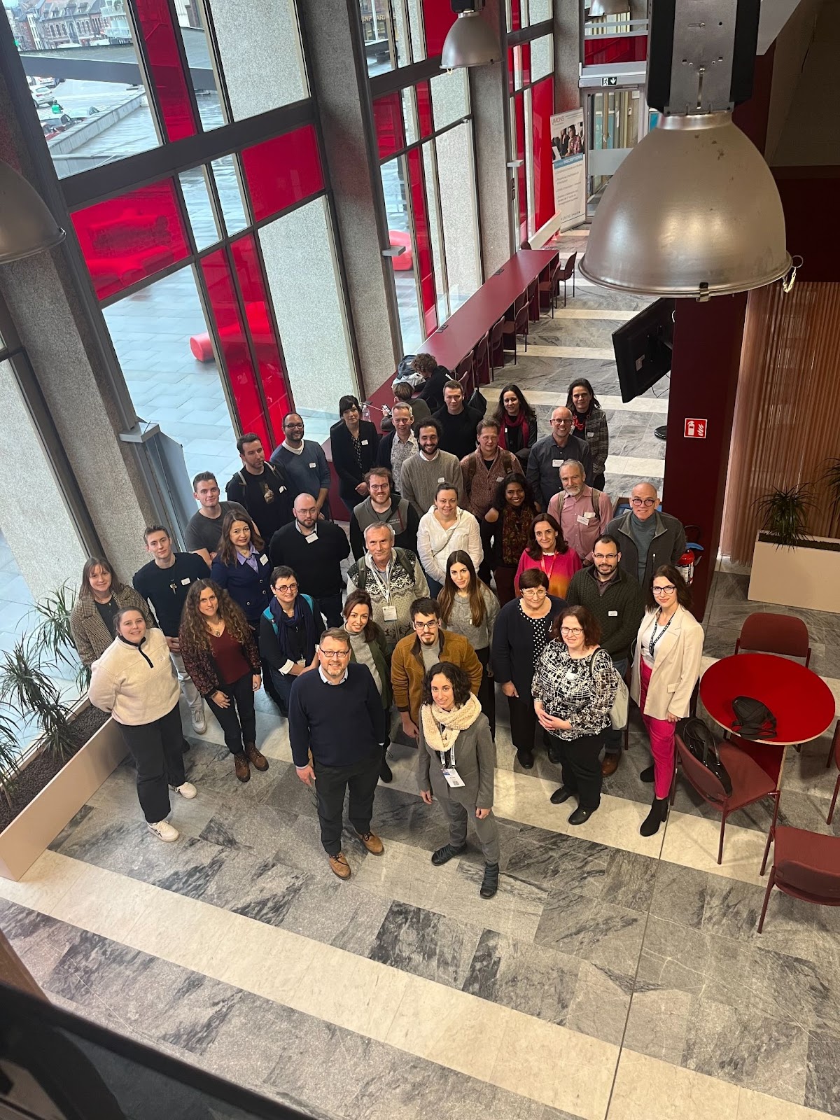
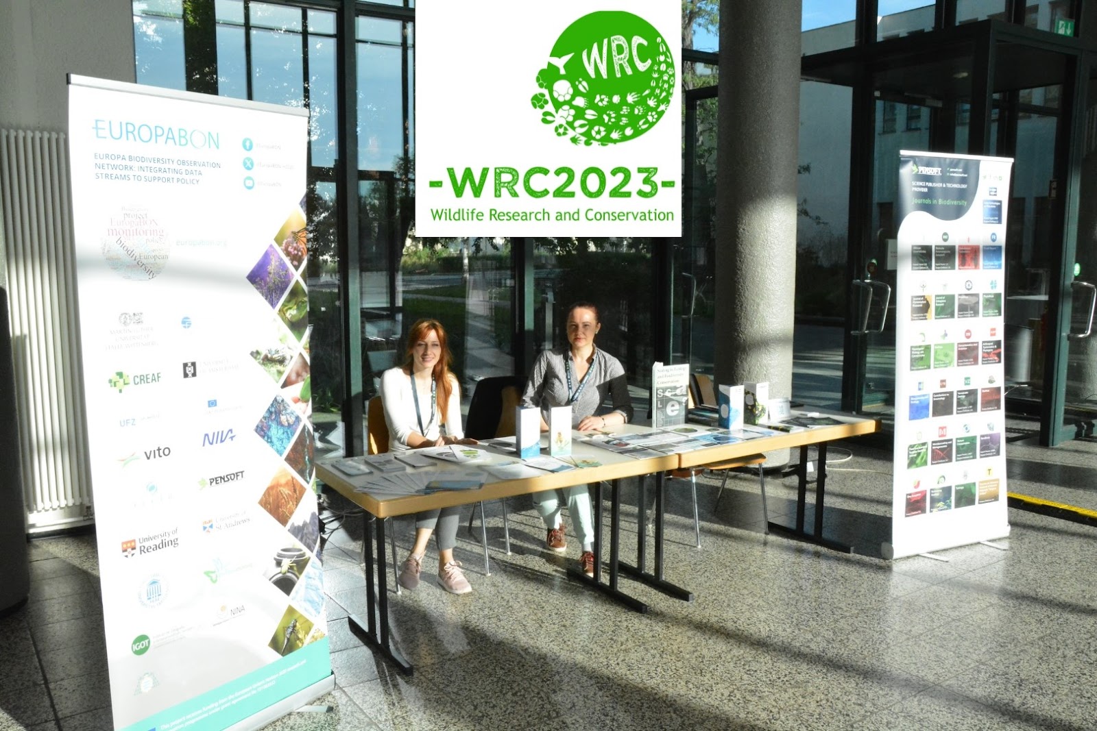
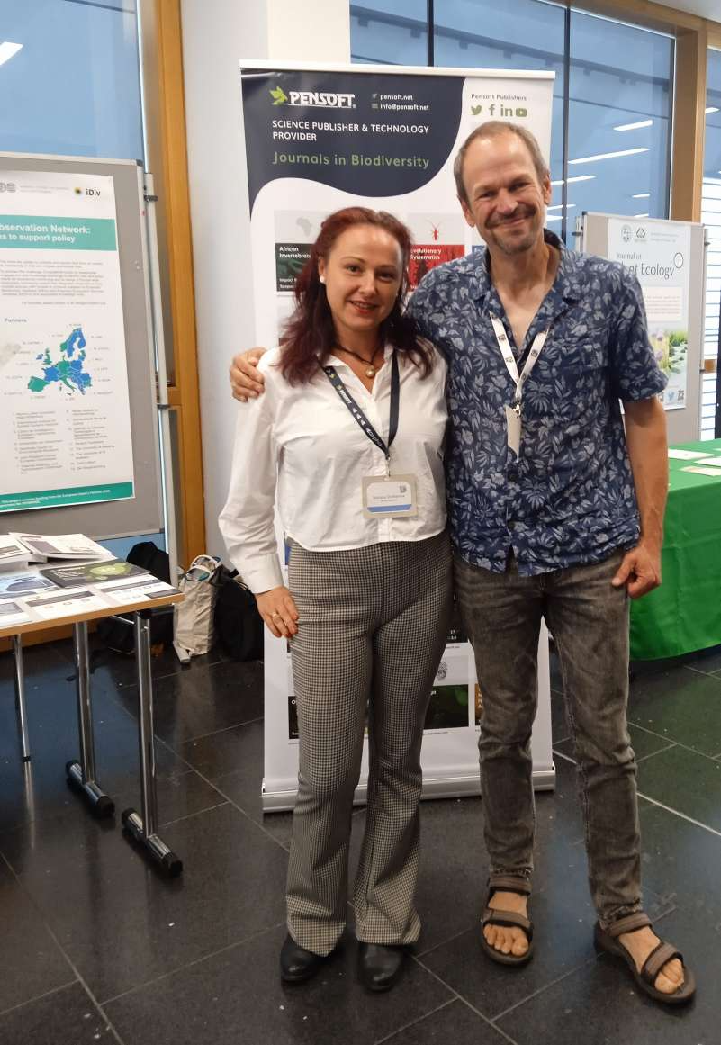
Pensoft representatives Mrs. Boriana Ovcharova and Mrs. Anna Sapundzhieva, ready to greet attendees in the sun.
The conference looked at evolutionary adaptations from the perspective of behavioural ecology, reproduction biology, genetics, physiology, as well as nature conservation. It particularly focused on the pressing issues of wildlife research and species conservation in the context of global environmental change. Most of the ≈100 participants were young scientists from more than 30 countries.
The Pensoft team greeted fellow attendees with an exhibition stand and presented the conservation and ecology-focused journals Neobiota, Nature Conservation, One Ecosystem, and Biodiversity Data Journal. Pensoft also advocated for EuropaBon, who are designing an EU-wide framework for monitoring biodiversity and ecosystem services, and REST-COAST, whose mission is to provide the tools to restore environmental degradation of rivers and coasts. Within both European-funded initiatives, Pensoft is a key dissemination partner that contributes expertise in science communication, scholarly publishing, and the development of digital tools and platforms.
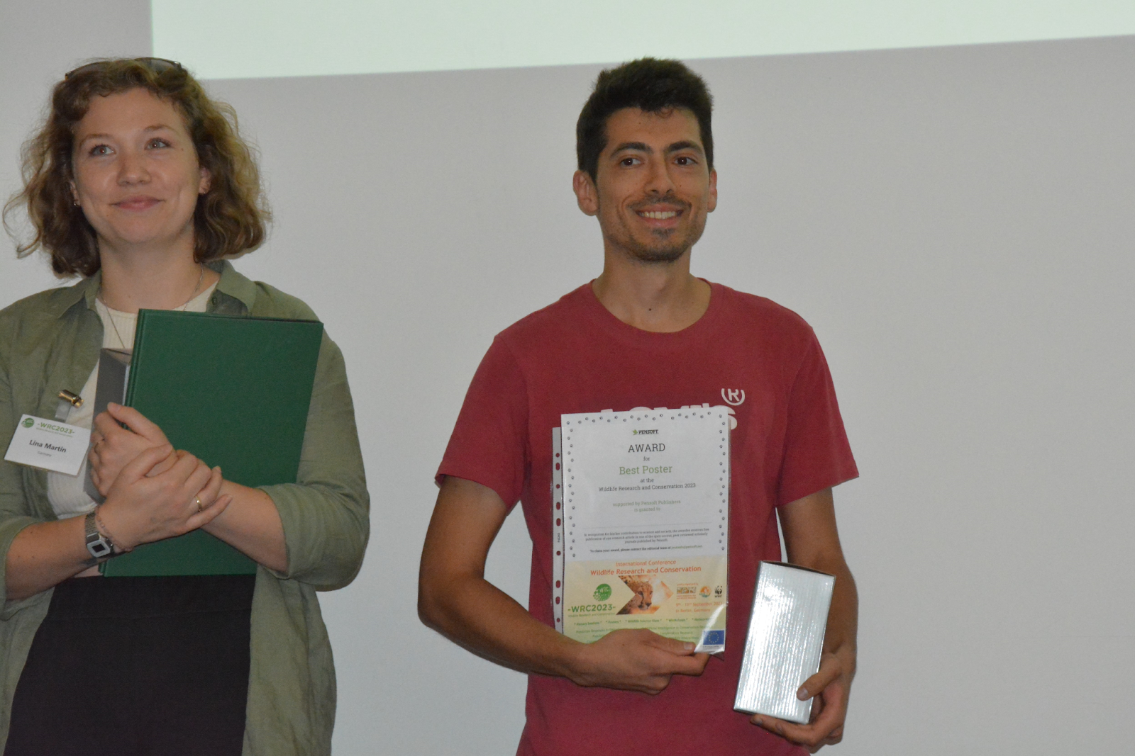
Joao Pedro Meireles posing with his Best Poster award.
Pensoft presented Joao Pedro Meireles from Utrecht University with the Best Poster Award for his research on pair compatibility in okapis, entitling him to a free publication in one of Pensoft’s open-access journals.
“My study looked at pair compatibility in the zoo breeding programme of Okapi. During breeding introductions, sometimes the male becomes aggressive towards the female and we decided to investigate the potential factors. We ran a survey among all zoos that house the species in Europe and we found that differences in husbandry were linked to the aggressiveness performed by the males.”
Joao Pedro Meireles, Utrecht University
GfÖ Annual Meeting 2023
From the 12th to 16th of September, the German Centre for Integrative Biodiversity Research hosted the 52nd Annual Meeting of the Ecological Society of Germany, Austria and Switzerlandin Leipzig, Germany. The meeting welcomed more than 1,100 participants from around the world, including scientists, policymakers, educators, and environmental enthusiasts.
This year’s meeting was held with the theme: “The future of biodiversity – overcoming barriers of taxa, realms and scales.” There was a particular emphasis on future challenges and opportunities facing biodiversity, and how to address and manage these in an interdisciplinary and integrative way.
Mrs. Boriana Ovcharova (Pensoft) with Neobiota Editor-in-Chief Prof. Dr. Ingolf Kühn.
Conference participants were welcomed at the Pensoft stand, where they could learn more about the projects EuropaBon and SELINA, which deal with biodiversity, ecosystem and natural capital topics.
Also in Leipzig, the European Conference on Ecological Modellingtook place between the 4th and 8th of September. The event focused on the transformation of how societies deal with natural resources in a world where biodiversity and ecosystem services are at high risk.
The ECEM 2023 continued a series of conferences launched by the European chapter of ISEM, the International Society for Ecological Modelling. ISEM promotes the international exchange of ideas, scientific results, and general knowledge in the areas of systems’ analysis and simulations in ecology, and the application of ecological modelling for natural resource management.
📢Shutout to all attending the #ECEM23@ECEM_2023#ecological#modelling conference TODAY in Leipzig! Make sure to visit the poster session during lunch & find about the unique article types welcome to our #journal! 💡They intend to disseminate models PRIOR TO implementation! https://t.co/dUVskYFK11
— Food & Ecological Systems Modelling Journal, FESMJ (@FESMJournal) September 5, 2023
The Bundesinstitut für Risikobewertung team presented a poster on the Formal Model format and potential new MiDox formats, unique publication types that can be submitted to Pensoft’s Food and Ecological Modelling Journal.
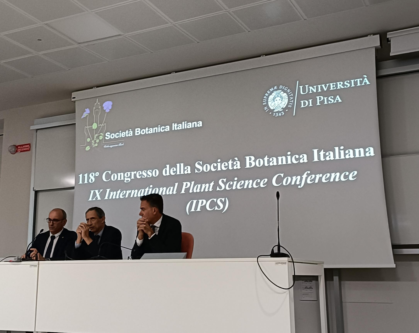
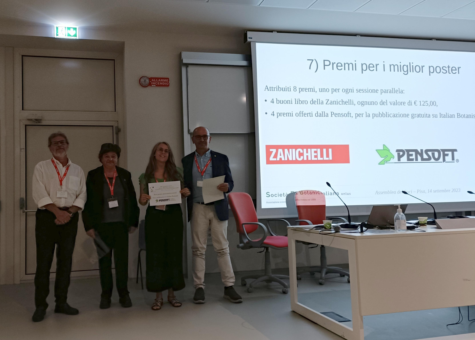
118th Congress of the Italian Botanical Society
Speakers at the 118th Congress of the Italian Botanical Society.
Pensoft was proud to sponsor the 118th Congress of the Italian Botanical Society, which took place in Pisa, Italy from the 13th to 16th of September. Experts in various fields of Botany gathered to share their research on the following topics:
Journals promoted by Pensoft at the 94th Annual Meeting of the Paläontologische Gesellschaft.
Summer may be well and truly over, but as a new academic year begins, Pensoft looks forward to attending more conferences, rewarding more incredible research, and connecting with more of the scientific community. Thank you to everyone who contributed to or engaged with Pensoft’s open-access journals this year, and here’s to a successful final quarter of 2023.